


With summer just around the corner, many of us are looking for new and exciting ways to explore the world without leaving our homes. Google Earth is a great option for armchair travelers and curious minds alike. In this app review, we will take a look at Google Earth and what it has to offer users. From 3D mapping to street view features and more, read on to learn all about this popular app.
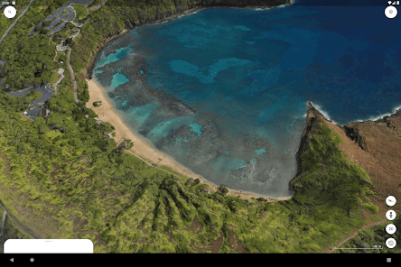
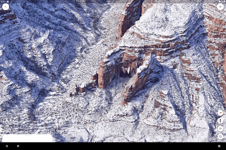
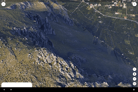
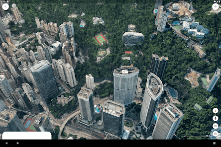
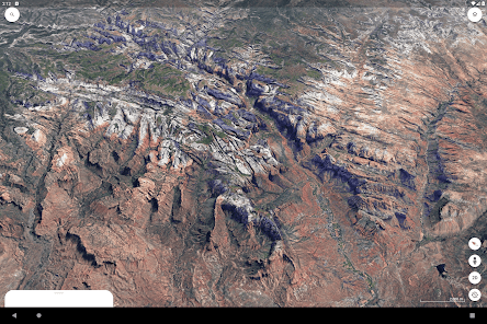
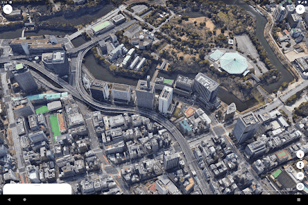
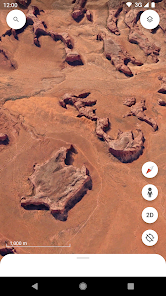
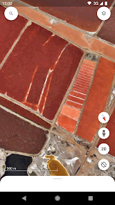
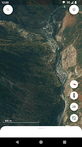
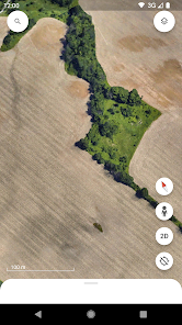
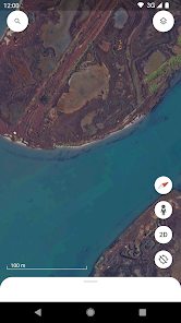
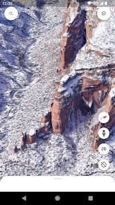
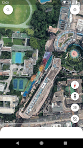
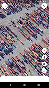
Overview Google Earth is a free application that allows users to explore the world in 3D. It offers a variety of features including the ability to view satellite imagery, topographic maps, and even Street View images. Google Earth can be used on both desktop and mobile devices, making it a versatile tool for exploring the planet. One of the best things about Google Earth is that it’s constantly being updated with new data. This means that you can always find the most recent satellite imagery and topographic maps. And, if you’re using Google Earth on a mobile device, you can even view Street View images of your current location. Overall, Google Earth is an excellent application for exploring the world around you. Whether you’re looking for satellite imagery, topographic maps, or Street View images, it’s a great option. Features Google Earth is a free application that you can download to your computer or mobile device. Once installed, it gives you the ability to view satellite imagery of the earth’s surface, as well as 3D models of buildings and other landmarks. You can use Google Earth to explore different parts of the world from the comfort of your own home, or even plan a future trip by checking out potential destinations. The app also includes a layer of information about points of interest, so you can learn more about the places you’re looking at. One of the best features of Google Earth is the Street View function, which allows you to see what a place looks like in real life. This is particularly useful for getting an idea of what a destination looks like before you visit it. Overall, Google Earth is an incredibly useful and fun tool that everyone should check out. How to use Google Earth? Assuming you have already downloaded and installed Google Earth, launch the program. You will be presented with a three-dimensional globe. To navigate, you can use your mouse to click and drag the globe in any direction, or you can use the navigation controls in the upper-left corner of the screen. There are several ways to find locations using Google Earth. You can search for a specific location by typing its name into the search bar in the upper-right corner of the screen. Alternatively, you can browse through the "Places" panel on the left side of the screen. This panel contains a variety of different layers that you can turn on and off, including political boundaries, points of interest, and even 3D buildings. Once you've found a location that you're interested in, you can learn more about it by clicking on the "Info" button in the upper-left corner of the screen. This will open up a new panel with information about that location, including its Wikipedia entry (if available). Finally, don't forget that you can also view satellite imagery and even Street View data in Google Earth. To do this, simply zoom in close to a location and then switch to either the "Satellite" or "Street View" layer from the "Layers" panel on the left side of the screen. How does Google Earth work? Google Earth is a free, downloadable software that enables users to view satellite imagery of the earth’s surface. In addition to visualizing satellite data, Google Earth also includes a search engine that allows users to find specific locations on the globe. To use Google Earth, users must first download and install the software on their computer. Once installed, users can launch the program and begin exploring the earth’s surface. Satellite images are displayed in the program window, and users can navigate around the globe by clicking and dragging their mouse. In addition to viewing satellite images, Google Earth also includes a number of other features that allow users to learn more about specific locations on the globe. For example, users can view Street View images of select cities, which provide a ground-level view of popular tourist destinations. Users can also view information about points of interest by clicking on them in the program window. What are the benefits of using Google Earth? There are many benefits of using Google Earth, including the ability to: View satellite imagery of anywhere in the world Get driving directions and find businesses View street maps and 3D buildings See real-time traffic conditions Explore different areas in 360-degree panoramas Find out about different cultures and locations Does it cost to use Google Earth? There is no charge to download and install Google Earth on your computer or mobile device. However, if you want to use the Google Earth Pro features, you will need to pay a yearly subscription fee. The good news is that the subscription fee is currently waived for all users. Pros & Cons Google Earth is a free, downloadable software application that lets users view satellite imagery of the Earth. It’s been around for over a decade and has been used by everyone from scientists to students to curious armchair travelers. While it’s an incredibly powerful tool, it does have its drawbacks. Let’s take a look at the pros and cons of Google Earth. Pros: One of the most impressive features of Google Earth is the high-resolution satellite imagery. You can zoom in from space all the way down to street level in many cities around the world. The images are so clear that you can even see individual cars and people in some cases. Another great feature is the ability to view historical imagery. Google Earth has a time slider bar that lets you see how an area has changed over time. This can be really interesting to see, for example, how a city has grown or how a natural disaster has affected an area. Google Earth also offers 3D viewing in many areas. This means that you can fly virtually over mountains, buildings, and other landmarks in select cities around the world. It’s a fun way to explore places you may never get to visit in person. Cons: One downside of Google Earth is that it can be slow to load, especially if you’re trying to view high-resolution images or 3D content. Another potential drawback is that


Google Earth may collect certain usage data and information to improve its services, but it adheres to Google's privacy policies regarding user data and privacy.
Google Earth offers a free version that provides access to many of its features, while Google Earth Pro is also available for free, offering additional tools and capabilities.
Yes, Google Earth requires an internet connection to access its features and to download the latest satellite imagery and map data.
You can contact support or send feedback through the Google Earth Help Center, where you can find resources and options to report issues or provide suggestions.
Since Google Earth Pro is free, there is no subscription to manage or cancel. For any paid services related to Google, you can manage subscriptions through your Google Account settings.
You can reach Google Earth customer service via the Google Support website or through the Google Earth Help community for specific queries.
Google Earth does not have a dedicated customer number; support is primarily available online through the Help Center.
Open the Google Earth app, click on the menu, select "Sign In," and enter your Google account credentials.
Google Earth typically does not require activation; simply download the app and log in with your Google account to start using it.