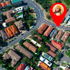

Live Satellite View provides real-time satellite imagery for navigation and exploration, ideal for users needing detailed aerial perspectives. Waze, on the other hand, focuses on crowd-sourced traffic data and route optimization, offering live updates on road conditions. Both serve navigation purposes but differ in their visual approach and information sourcing.
| App Name | Live Satellite View GPS Map | Waze Navigation & Live Traffic |
|---|---|---|
| App Type | Navigation | Navigation |
| Limitations | Requires internet connection, may drain battery quickly, limited offline access. | Requires internet for full functionality, may drain battery quickly |
| Pricing Model | Freemium | Freemium |
| Primary Use Case | View real-time satellite imagery and GPS maps. | Provides maps, navigation, and traffic updates for users. |
| Target Audience | Travelers, outdoor enthusiasts, and navigators. | Drivers and commuters seeking navigation assistance. |
| App Name | GPS+ Maps, Navigation, Traffic |

 Real-time updates enhance navigation accuracy Discover new routes with ease and efficiency Visualize terrain for better trip planning Locate nearby amenities instantly for convenience Experience immersive exploration from anywhere
 Limited real-time updates can mislead navigation High data usage drains mobile battery quickly Privacy concerns arise from location tracking Poor visibility in bad weather affects accuracy Real-time traffic updates help avoid congestion and save time. User-friendly interface ensures easy navigation for all users. Offline maps provide access even without an internet connection. Customizable routes allow for personalized travel preferences and shortcuts. Voice-guided directions enhance safety by keeping eyes on the road. Limited offline access can hinder navigation in remote areas Constant reliance on data can drain battery life Inaccurate traffic data may lead to unexpected delays
 Live Satellite View, GPS Maps, and Waze serve distinct purposes within the navigation app ecosystem. Live Satellite View primarily offers real-time satellite imagery, providing users with a bird's-eye view of their surroundings. This feature is particularly beneficial for those interested in landscape and geographic details. In contrast, GPS Maps focuses on standard navigation with turn-by-turn directions, address searches, and route planning, making it suitable for everyday travel needs. Waze stands out as a community-driven navigation app that emphasizes real-time traffic updates and user-generated content, such as hazard reports and road closures, ensuring the most efficient routes are taken based on current conditions.
When it comes to features, each app presents unique offerings. Live Satellite View excels in high-resolution imagery and the ability to view specific locations from above, making it excellent for planning outdoor activities or surveying landscapes. GPS Maps provides robust mapping features, including offline maps, points of interest, and integration with public transport schedules. Waze, on the other hand, integrates social features that allow users to report traffic incidents, speed traps, and even police presence, leading to dynamic route adjustments. Additionally, Waze includes voice navigation and estimated time of arrival (ETA) calculations that adapt based on real-time traffic data.
Pricing models vary significantly across these apps. Live Satellite View typically operates on a freemium model, offering basic functionality for free while charging for enhanced features like higher-resolution images or additional layers. GPS Maps is often available for free with in-app purchases for premium features, such as offline downloads or ad-free experiences. Waze is free to use, relying on advertisements and partnerships for revenue, making it a cost-effective choice for users who prioritize real-time traffic information without any financial commitment. This makes Waze particularly appealing for users looking for a no-cost solution to navigate efficiently.
In terms of usability, the apps cater to different user preferences. Live Satellite View provides a straightforward interface focused on visual exploration, though it may require a learning curve for users unfamiliar with satellite imagery. GPS Maps features an intuitive interface that is easy to navigate, with clear options for route planning and searching for locations, ensuring users can quickly find their way. Waze offers a user-friendly experience with frequent updates and prompts, but it can be somewhat cluttered due to its emphasis on community interactions and ads. Ultimately, users may prefer GPS Maps for traditional navigation, while Waze appeals to those who value real-time updates and community engagement in their travel experience.
Live Satellite View may lack the real-time traffic updates that Waze provides, making it less effective for navigation during busy periods. Conversely, Waze's reliance on internet connectivity may limit its use in areas with poor service.
Live Satellite View allows for some offline viewing of downloaded maps, but Waze requires an internet connection for its real-time traffic features and navigation updates. Users needing offline functionality should consider this distinction.
Live Satellite View features a straightforward interface centered on maps and imagery, while Waze has a more dynamic design with interactive elements for traffic updates and navigation prompts. Interface preferences may vary based on user needs.
Alternatives to Live Satellite View include Google Maps and Apple Maps, which also offer satellite views. For traffic-focused navigation like Waze, alternatives include Google Maps with real-time traffic and HERE WeGo, which offers offline capabilities.
Live Satellite View specializes in providing detailed satellite imagery and GPS mapping, whereas Waze focuses on real-time traffic updates and navigation based on community reports. Users seeking satellite visuals may prefer Live Satellite View.

Cash App


Venmo
Cash App and Venmo are mobile payment platforms that allow users to send and receive money easily. Cash App offers features like investing in stocks and Bitcoin, while Venmo focuses on social payments with a social feed for transactions. Both apps provide convenient peer-to-peer payment solutions but cater to different user needs.
Compare Now
Simmons Bank

Citi Mobile®
Simmons Bank and Citi are both financial services apps offering banking solutions. Simmons Bank focuses on local banking needs with personalized services, while Citi provides a broader range of global financial products and services, catering to both personal and business customers. Users can choose based on their specific banking requirements and geographic preferences.
Compare Now





 Home
Home  Apps
Apps  Games
Games  Topics
  About Us
  Cookies & Privacy Policy
  Terms of Service